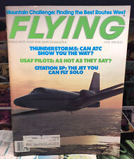
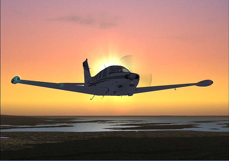
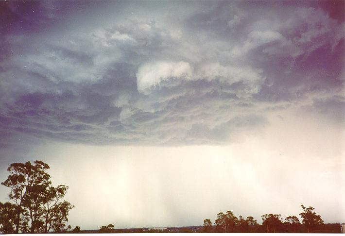
You need to know only one thing about thunderstorms. They’re lethal. Stay away, Thunderstorms can readily strike planes and people from the air. However, many characteristics of thunderstorms, specifically, how they breed and evolve, can help you to evade them and their hazards.
We’re still evolving from our infancy to adolescence in understanding thunderstorms. If you subscribe to the Book of Genesis, we had all the ingredients of thunderstorm formation by the fourth day of creation: sun , land and water. How many millons of year passed until 1947? That’s the year the Departament of Commerce (in a study titled “Project Thunderstorm”) first labeled the nomenclature, the stages of storm life: cumulus, mature and dissipating.
I’ve called 1975 “The Year of the Shear”. Only 30 years after Project Thunderstorm, it was recognized that thunderstorms had been woefully underestimated in the velocity of outflow: “wind shear” became the industry’s ominous buzz word. The expression “downdraft” was pathetically inadequate to describe a storm’s dissipating power , and new, more descriptive words were coined: “downburst” and “microburst”. Wind shear actually waited for the jet age. The heavy jet aircraft didn’t have the performance – the response versality- of older prop driven airliners, but that’s another topic.
The United States has 10,000 severe thunderstorms each year and 1000 tornadoes. Only China has that quantity of severe storms, but has less than 10 tornadoes. Since thunderstorms are the product of geography and water supply, think of the mountain commonality shared by the United States and China. Cold fronts are channeled and routed to become efficient lifting forces, especially by the Rockies in our country.
No other country shares with us the latitude, often sever cold from invasions, mountain boundaries and Gulf of Mexico as a water source. If you fly in the United States, especially east of the Rockies, thunderstorms must be a focus in your meteorology education.
1)Radar identifies thunderstorms: Not true. Radar is a water detector. One of the characteristics of thunderstorms displayed on radar is localized cells of water, representing the strenght of the updraft. But, rain showers and even heavier stratus drizzle can present “red” (apparent hazard) on a radar display. Radar can identify and locate what you expect along your path by virtue of an extensive, educated preflight examination of weather. Hazardous red, without and expectation of weather to be encountered, can be equally as puzzling as illuminating. Radar doesn’t identify thunderstorms. It displays a by product of storms: Water.
Electrical (lightning) detectors identify thunderstorms: That’s true, but not all that you need to consider. The National Weather Service’s definition of a thunderstorm is: “contains thunder and lightning”. But, ‘spherics devices, like the Stormscope and Strikefinder, can’t precisely define the area (diameter and circumference) of a thunderstorm, only that a group of lightning strikes are occurring. Wide avoidance criteria must be given, since the storm cicumference can be much larger than the lightning strike area being displayed. And ‘spherics devices can’t identify heavy water areas that you might want to avoid even if not a thunderstorm.
Radar identifies all water to be avoided, some of which is thunderstorms. ‘Spherics devices identify lightning, but not all the areas you should avoid. Building cumulus clouds can contain distrubing turbulence and icing and not even be a thunderstorm. Obviously, having both devices on the airplane is the best of both worlds.
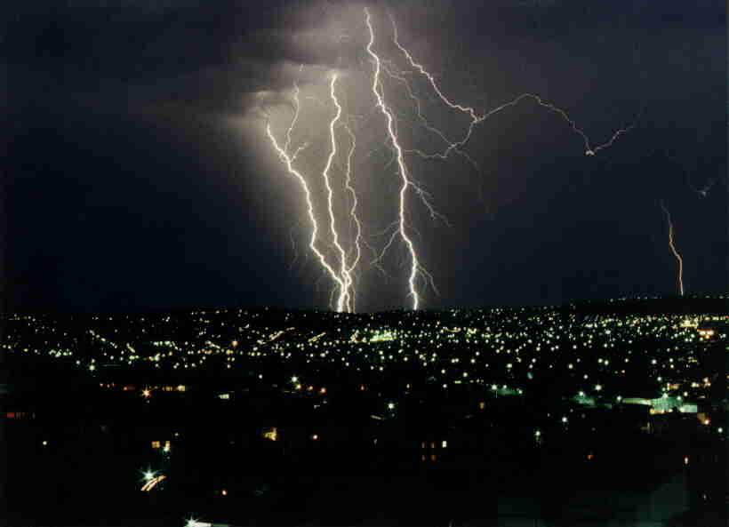
All lightning strikes are airborne disasters: In fact, they aren’t, In our country , we had 2507 fatalities and 6219 injuries from lightning strikes over a 25 year period. They were all ground bound beings. Lightning is best treated as fatal, and all lightning areas should be avoided accordingly. In a plane, however, the charge is quickly diffused over the large area of aircraft skin. Tires don’t protect occupantes of cars; diffusion of the charge does.
Power surges may dirupt avionics, but passengers aren’t injured. Long ago, we learned how to vent and protect fuel systems. It takes about three million volts per lineal yard of polarity differential to energize a lightning strike. Scientsist still don’t agree on what exacty polarizes a could. Additionally , there’s not agreement on whether an airplane attracts lightning, , whether it simply and unfortunately flies into the path, or whether carbon exhaust trails become conduits for lightning . Lightning strikes are spiritually awakening experiences, frightening, but not fatal.
All thunderstorms are created equal: You know that’s not true. We have general or air mass storms (short-lived) and severe thunderstorms (winds of 50 knots or greater, three-quarters of an inch or larger destructive hail and tornadoes.) Thunderstorms can be steady state, leaning so that the rain shaft never extinguishes the updraft channel. Dangerous and more dangerous aren’t plausible premised, but true. It’s the vertical development of storms and the effects of higher altitude winds that determines the breed.
Any thunderstorms can contain sufficient turbulence and hail to disable light general aviation aircraft. If we classified them as weaponry (a .45 caliber, 105-Howitzer and nuclear), you’d more easily recognize your inability to compete. There are just some thunderstorms that will kill you faster and some that aren’t so merciful. They’re equal only in their ultimate destruction of airplanes.

Cold fronts and convective heating creates thunderstorms: That’s true, but thunderstorms create thunderstorms, too. In a tragic 1985 Dallas/Ft. Worth wind shear accident, it was the outflow of thunderstorms along the Red River (60 miles away) that created the mini-cold front that built massive thunderstorms at the airport. Whenever a thunderstorms dissipates, it generates an outflow cold front that encourages further thunderstorm development. Whatever fosters lifting encourages a thunderstorm. The outflow winds from High , cold altitudes are pseudo cold fronts. At DFW that day, the resulting storm built at 5000 to 8000 fpm assisted by 100 degree F weather. All the atmosphere needed was a nudge, and the outflow from storms effected it.
The higher the tops, the more predictably hazardous the storm: That’s true, but inadequate. We think of storm tops in the 45,000 to 50,000 MSL levels. A study of midwestern thunderstorms indicates that one in three at 30,000 feet will contain severe hazards and, by 37,5000 feet, the severe storm probability is one out of two. Furthermore, hail-producing storms normally exceed the freezing level by 10,000 feet or more. In hot summer months, the freezing level is typically 20,000 feet MSL.
Don’t be too impressed with the “highest top” when concern should be kindled by 30,000 MSL. Again , at DFW that day, the 43,000 foot top was considered by the forecaster to be only a “garden variety Texas storm”. It had a 70 percent probability of being severe and was monstrously so. (A weather warning was never issued. No one heard “thunder” before the accident. What a ridiculous standard!)
All level III radar returns are hazardous: Not necessarily true. If convective, that should be regarded as true. A Level III return is 0.5 inches/per hour on radar, and often it’s stratus rain. Even if convective, the red return begins at 40 dBz of echoed radar strength. Documented destructive weather begins at 45 dBz. There’s a five dBz buffer area and that promotes safety. If one avoids convective radar returns, safety is served. With and extensive preflight inspection of weather, Level III returns might be expected and absolutely bening as stratus rain from a warm front in a water plentiful area. So all returns aren’t hazardous, but no one was ever in trouble avoiding a non-hazardous area.
Wind shear is unpredictable: That’s not true. There are two kinds of convective wind shear producers; the massive raining thunderstorm and one called “desert type”. The dividing line between the two is about Kansas City, Kan, with a north-south line along that longitude. East of Kansas City, the highly radar reflective, awesomely apprearing thunderstorms as we know them certainly invites you to a multitude of hazards. Wind shear is one of them.
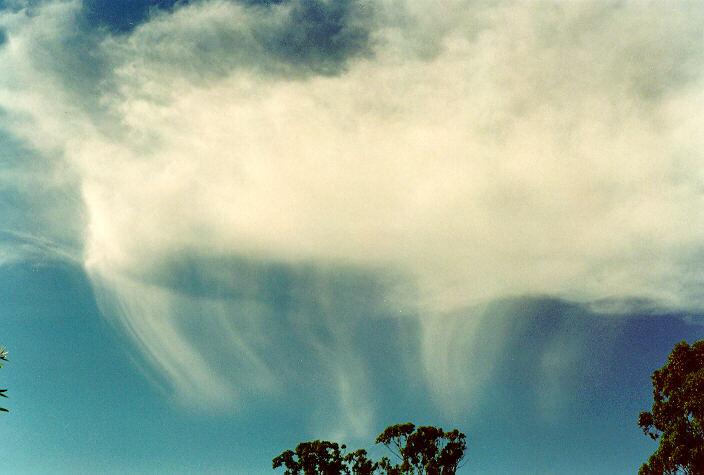
West of Kansas City, the high plains, desert-type storm has little radar reflection. They have high, unthreatening and inviting cloud bases. They usually rain as Virga, precipitation that doesn’t reach the ground. Evaporating is cooling, cooling is acceleration. Avoid Virga and localized blowing dust. Avoid the monsters that rain heavily and drag airflow downward. Avoid towering cumulus over 40 degree temperature dew point spreads that promote evaporing Virga.
Be alert to wind shear from about 11 am to 6 pm the highest heating of the day. What goes up must come down. Avoid arid environments the promote evaporating rain.
The highest reflectivity of the storm is also the hightest hazard area: Not true at all . In a midwestern storm study. “Project Rough Rider”, it was stated: The greatest hazard was often not in the area of highest reflectivity. Whatever hazard is represented by the updraft strenght and radar return is present throughout the entire diameter and circumference of the cloud form. It may be found in a green area (Level I) or a yellow area (Level II).
Be aware of appending clouds. From a radar perspective, when a storm core paints “red” the entire cloud mass cloud be displayed as red (eliminating green and yellow) and be accurate from a turbulence and hail point of view. Also avoid the updraft-downdraft areas surrounding the storm that aren’t radar reflective at all. The storm core is only representational of the updraft strenght that exists throughtout the storm. It doesn’t identify the hazard area in total.
Storms are omni-directionally dangerous: That might be true, but south and southwest sides of storms qualify for that “more dangerous” identity. Our typical midwestern thunderstorm is fed from the Gulf of Mexico. It’s the updraft side. That’s why tornadoes occure on the south to southwest side, depending upon how far easterly it’s moved .Inflow from the Gulf promotes a low pressure area by basic Bernoullly dynamics. Low pressure areas swirl counterclockwise. Take swirling updraft, good upper wind support and bing: Tornado. Avoid the south side of thunderstorms, particularly the south side of “lines” -triple avoidance around the south side of lines for the storms developing that you don’t yet see.
With all of our knowledge, we still don’t fully comprehend all of the impressive mechanics of nature’s most destructive presence. We don’t know why they pulsate in wind shear outflows. Often, it’s what you don’t know that injures you quickly. We began with on simple axiom: Avoid them all. Learn as much as you can but avoid them all.
Maybe the ancient cultures weren’t that far wrong when they viewed lightning as a cosmic stroke indicating the power of a celestial being. Learn everything you can about thunderstorms- avoid them religiously.