When you click on links to various merchants on this site and make a purchase, this can result in this site earning a commission. Affiliate programs and affiliations include, but are not limited to, the eBay Partner Network.
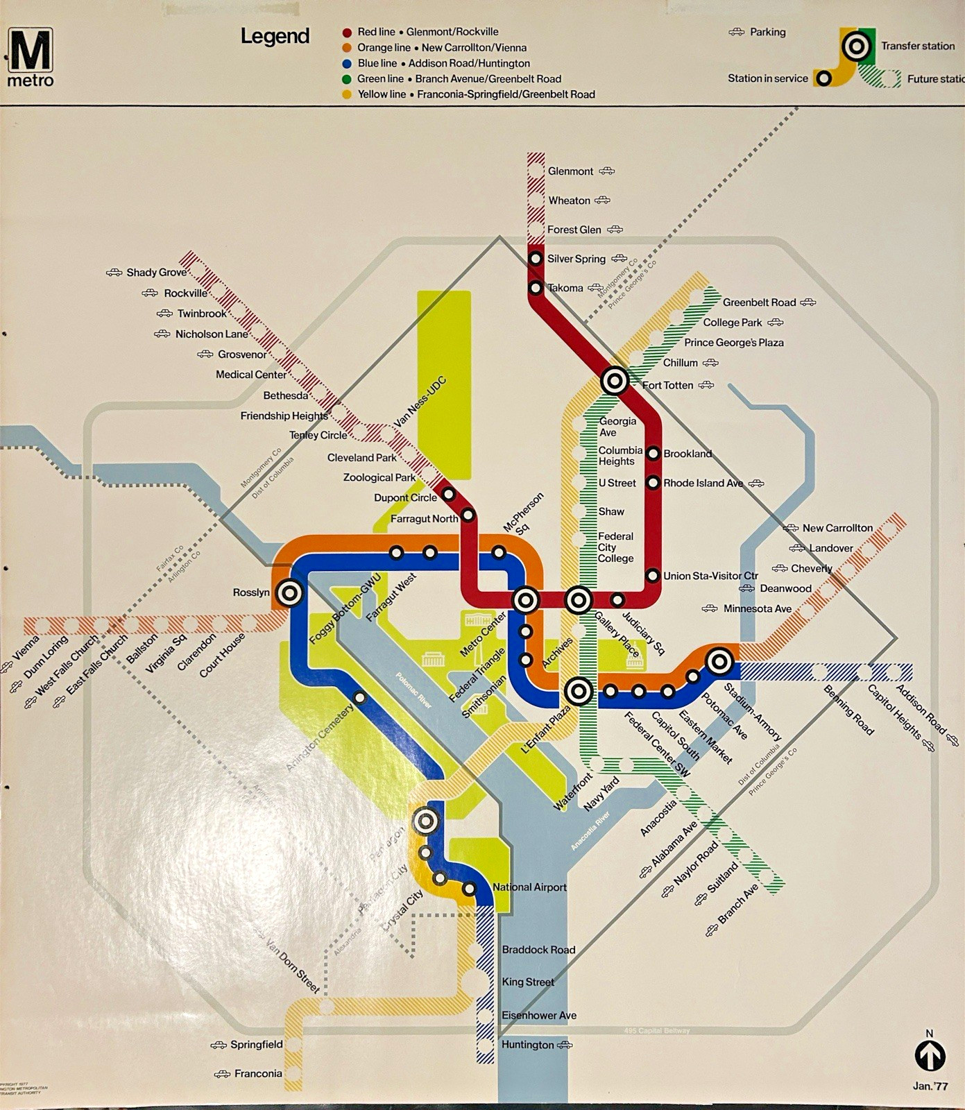
Vintage January 1977 Washington, D.C. Metro Subway Map – 36” x 32” - Early WMATA System Design
A fascinating piece of Washington, D.C. transportation history! This January 1977 Washington Metropolitan Area Transit Authority (WMATA) Metro map captures the capital’s subway system in its earliest years, when nearly the entire network was still in the planning stages.
Dating to less than one year after the Metro began passenger service in 1976, this historic map illustrates the ambitious original vision for Washington’s rapid transit system.
* Early Metro History: At the time of this map, only the Red Line between Dupont Circle and Rhode Island Avenue was operating. The remaining routes were shown as planned future service.
* Original System Design: Remarkably, the map depicts much of the network that would eventually be completed over the following decades, including the Green Line extension to Branch Avenue, which opened in 2001.
* Historic Station Names: Features early station names and proposed routes, including several that were subsequently changed before construction.
* Unusual Route Configurations: The Blue and Yellow Lines south of the Pentagon appear in a different configuration from the system eventually built.
* Classic Graphic Design: Features the clean, minimalist visual style associated with renowned designer Lance Wyman and the original Washington Metro map.
This map offers a remarkable glimpse into the early planning and development of one of America’s most recognizable subway systems. Its uncluttered design, distinctive colored routes, and historic station information make it an appealing example of 1970s transportation cartography.
An excellent collectible for Washington, D.C. history enthusiasts, Metro and subway memorabilia collectors, transit historians, cartography enthusiasts, and admirers of mid-century and 1970s graphic design.
A wonderful opportunity to own a visual record of the Washington Metro system during its formative years.
Condition: Please examine the photographs carefully for the map’s physical condition, dimensions, and any signs of age or handling. Notably, there are 5 small holes about 1/4” away from the side edges, and remnants of mounting tape on the back.
Ships free, carefully rolled up in poster tube (unless you specify otherwise) fully insured by carrier.