When you click on links to various merchants on this site and make a purchase, this can result in this site earning a commission. Affiliate programs and affiliations include, but are not limited to, the eBay Partner Network.
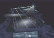
USAF/USN Enroute Low Altitude L-1/L-2 Chart 1964 From Seattle to San Bernardino
Description:
USAF/USN
ENROUTE LOW ALTITUDE
L-1/L-2
PUBLISHER:
Compiled and published by Jeppesen & Co. for the aeronautical chart and information center - United States Air Force
COPYRIGHT DATE:
28 May 1964 to 25 Jun 1964
DESCRIPTION:
A single sheet folded into eighteenths, B/W cover; B/W interior map illustrations.
CONDITION:
Map is in Good Condition with sunning to the cover; Rubbing to the edges; Closed tear to the cover; Staining to the back cover.
FEATURES:
Covers low altitude flight information from Seattle to San Bernardino; \"For use up to but not including 14,500\' MSL\"
inkfrog terapeak
inkFrog Analytics
Listing and template services provided by inkFrog